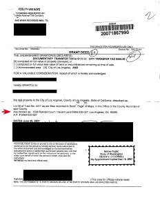
1538 Randall Court, Los Angeles, CA, 90065
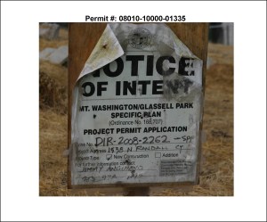
1538 Randall Court Parcel Plans (Case No. DIR-2008-2262-SPP, ENV-2008-2263-CE, Permit No. 08010-10000-01335):
1538 Randall Court LA County Assessors Map (APN 5464-030-027):

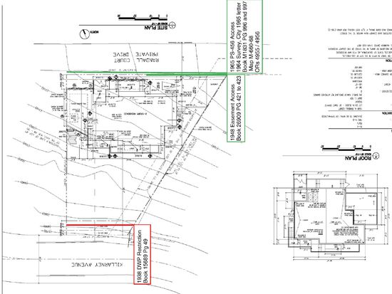
1538 Randall Court PS-456 Contour Map (1948 Easement Deed [Lot 28/] 40 is the easterly triangular lot portion of 1538 Randall Court, APN 5464-030-027):

Based upon:
April 1948 County Easement Deed
1538 Randall Court Government Data:

City of Los Angeles Randall Ct Topographic Map (Including 1538 Randall Ct Location)

1538 Randall Court Plot Photos:

1538 Randall Court Simplified Diagram:

Note: The only access is via Randall Court address, which is reflected on the deed, and in City & County records. Due to the southerly aerial easement, access via Killarney Avenue is prohibited.
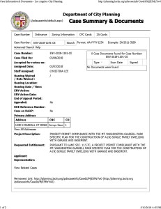
LÀ DCP Permit No. 08010-10000-01335:
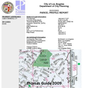
ZIMAS Parcel Profile:

LA DCP City Planning Legal Address (w.r.t LA City Planning & Parcel Deed):
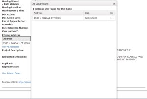
LA DCP City Planning SPP Case Summary:

LA DCP City Planning 1538 Randall Court Planning ENV CE Case Summary:
LA DCP City Planning 1538 Randall Court Parcel Profile Report (CD-1 – Ed P. Reyes, CD-14 – Jose Huizar):
Jose Huizar (US Case CR 20-326-JFW) 2008 [T0] – 2018:
George Esparza (US Case 2:20-cr-00208-SV):